When you click on links to various merchants on this site and make a purchase, this can result in this site earning a commission. Affiliate programs and affiliations include, but are not limited to, the eBay Partner Network.
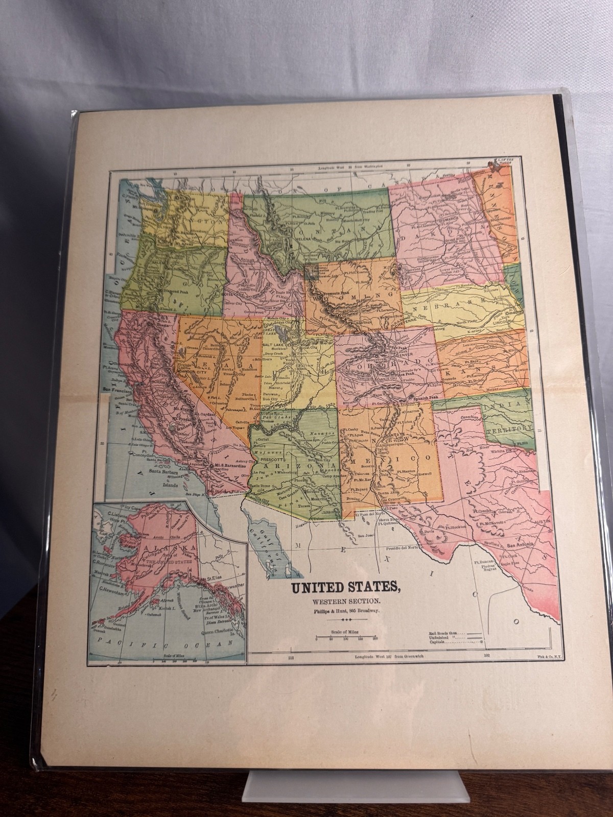
Antique United States – Western Section Atlas Map
Offered for sale is an antique map of the Western United States, published by Phillips & Hunt, New York. This is an original atlas page and not a modern reproduction.
This detailed map depicts the western portion of the United States, including California, Oregon, Washington, Nevada, Idaho, Utah, Montana, Wyoming, Colorado, Arizona, New Mexico, Texas, and surrounding regions. An inset map of Alaska is included in the lower left corner.
The map highlights state and territorial boundaries, major railroads, cities, and geographic features of the period, making it an outstanding collectible for anyone interested in Western Americana, railroad history, genealogy, or antique Title: United States – Western Section
* Publisher: Phillips & Hunt
* Original antique atlas page
* Includes Alaska inset map
* Printed on original paper
* Unframed
* Ships in a protective plastic sleeve with a rigid backing board
Condition
Very good antique condition with expected light age-related toning and minor wear consistent with its age. The map has been stored in a protective plastic sleeve with a rigid backing board and will be shipped flat for safe delivery.
I purchased this map from an estate/collector who presented them as antique maps.
Please review all photographs carefully as they are part of the description.