When you click on links to various merchants on this site and make a purchase, this can result in this site earning a commission. Affiliate programs and affiliations include, but are not limited to, the eBay Partner Network.
Genuine WWII RAF/USAAF aviation/navigation map —
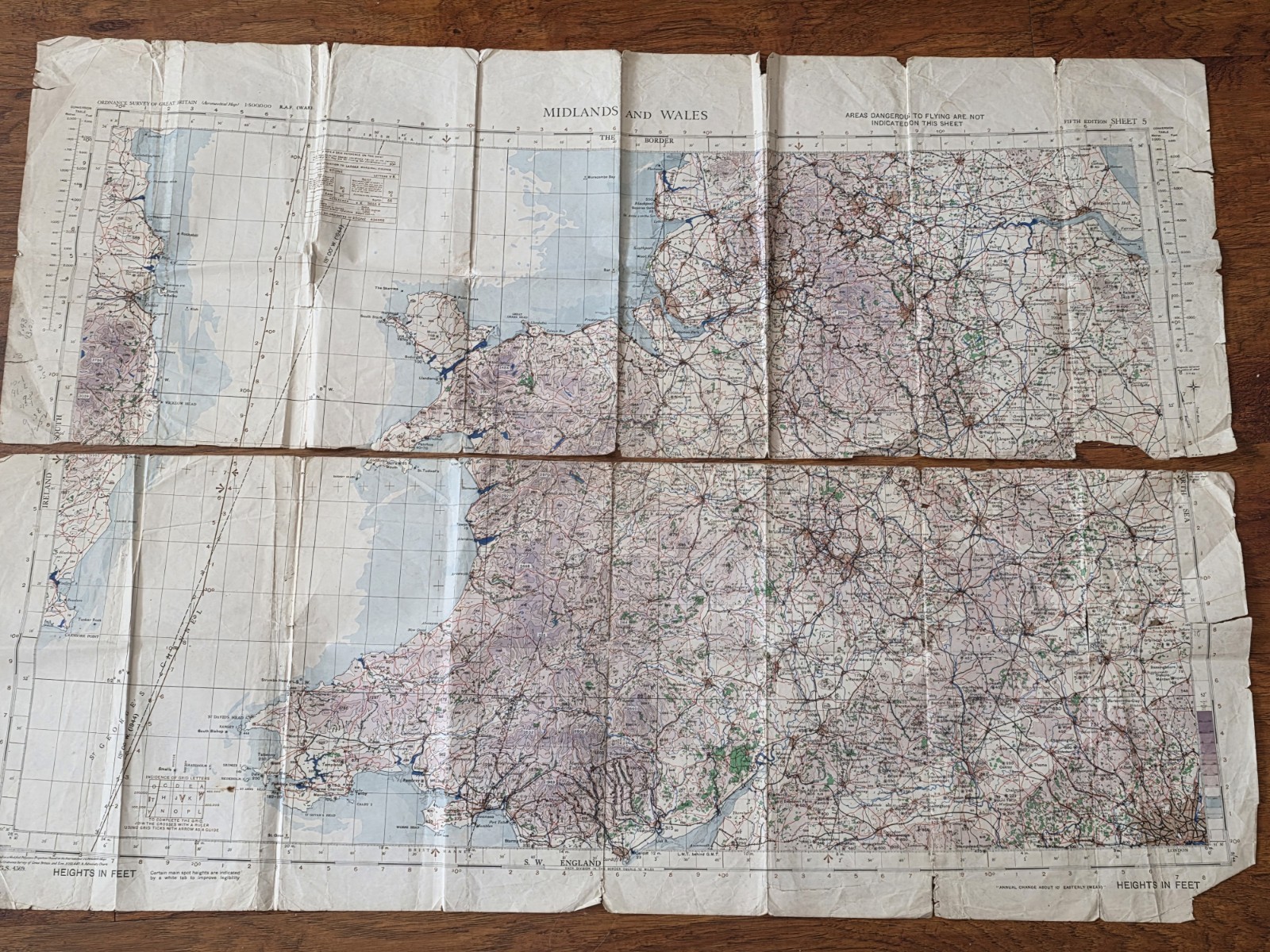
Ordnance Survey Quilt Aviation Map 1944-1945
Used by a USAAF B-17 navigator flying from English bases
Eighth Air Force
→ 1st Air Division
→ 457th Bombardment Group
Covering the Midlands and Wales / Southwest England
Has heavy operational wear; fold separation in two pieces, in half by the navigator, due to constant folding and handling inside the bomber and navigation compartments.
“ORDNANCE SURVEY AVIATION MAP”
“MIDLANDS AND WALES”
“4th Edition Sheet 5”
RAF-style aviation grid references
Air navigation projection notes
Fold pattern typical of cockpit use
The blue grease-pencil markings are navigation routes, checkpoints, coastal approach markings, or navigation annotations by the navigator.
It covers the Bristol Channel, Wales, western England, and the Midlands.
Concentrated near coastal and inland navigation corridors.
Condition-wise:
It has fold separation and edge wear. See photos.