When you click on links to various merchants on this site and make a purchase, this can result in this site earning a commission. Affiliate programs and affiliations include, but are not limited to, the eBay Partner Network.
Please note — sizing: due to the wide variety of sizes offered, some photos may be cropped slightly to fit. If you have any concerns, message us to request white borders.
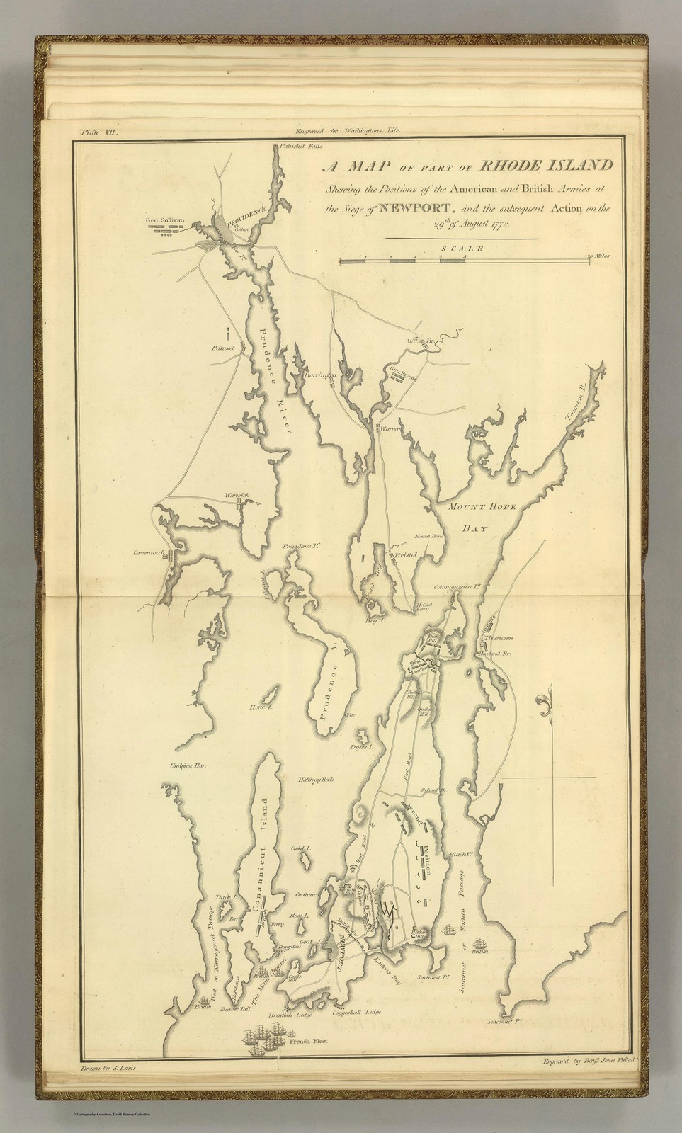
Historical cartographic map depicting part of Rhode Island during the American Revolutionary War, showing the positions of American and British forces at the Siege of Newport in August 1776. This detailed period map identifies key geographic features including Mount Hope Bay, various harbors, and military encampments. An exceptional artifact documenting colonial-era military geography and strategic positioning during a pivotal moment in American Revolutionary history.
Available Sizes
Choose your size from the dropdown above — each size is priced individually.
Gallery photos may show this print framed and styled in a room — that’s for display inspiration only. Your print ships unframed.
BUY 2, GET 1 FREE
Use code DIGITALSAVINGS at checkout — just add any 3 prints to your cart. Works on everything in our store.
Printed to order on premium Koala glossy photo paper for vibrant, true-to-original color. Ships within 1 business day, carefully packaged.
Please note: due to the wide variety of sizes offered, some photos may be cropped slightly to fit. If you have any concerns, message us to request white borders. Frame not included — prints ship unframed.
Digital Canvas — hundreds of historic photo prints & wall art.