When you click on links to various merchants on this site and make a purchase, this can result in this site earning a commission. Affiliate programs and affiliations include, but are not limited to, the eBay Partner Network.
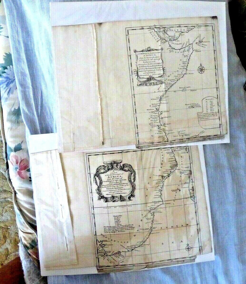
THIS sale IS FORA SET OF 2 ANTIQUE MAPS TITLED "1-A CHART OF THE EASTERN COAST OF AFRICA, FROM THE THIRTEENTH DEGREE OF SOUTH ; TO THE 16TH DEGREE OF NORTH LATITUDE, DRAWN FROM THE FRENCH CHART OF THE EASTERN OCEAN, PUBLISHED IN 1740 BY ORDER OF THE COUNT DE MAUREPAS; IMPROVED FROM PARTICULAR SURVEYS, AND REGULATED BY ASTRONOMICAL OBSERVATIONS,
2-A CHART OF THE EASTERN COAST OF AFRICA, FROM THE CAPE OF GOOD HOPE, TO CAPE DEL GADA,DRAWN FROM THE FRENCH CHART OF THE EASTERN OCEAN, PUBLISHED IN 1740 BY ORDER OF THE COUNT DE MAUREPAS; IMPROVED FROM PARTICULAR SURVEYS, AND REGULATED BY ASTRONOMICAL OBSERVATIONS"
EACH MAP IS APPROXIMATELY 10 INCHES BY 10 INCHES IN SIZE . THE SHEETS WHERE THE MAPS ARE ON MUCH LARGER (we don't know the sheet sizes as they are encased in Mylar.)
Bottom right corner of the sheets chipped, short tears at the bottom edge, otherwise A clean lot with lovely illustrations from 1740. RARE .
PLEASE DO SEE ALSO OUR OTHER SIMILAR LISTING.
COLLECTS SALES TAX.
Shipping andhandling costswill be $9.99byUSPS FIRST CLASS MAIL in the US.International rates are much higher.
Payment must be received within5 days of close of sale. We combine shipping for savings toour customers on multiple purchases. We pack carefully and ship immediately upon receipt of payment. As soon as we ship your item we leave a response. We appreciate tohaveyour response too. Thanks for browsing this listing.str DEF03