

|
Site Categories |
|
Featured Items |

Poodle, Spaghetti Trim, Ucagco


|
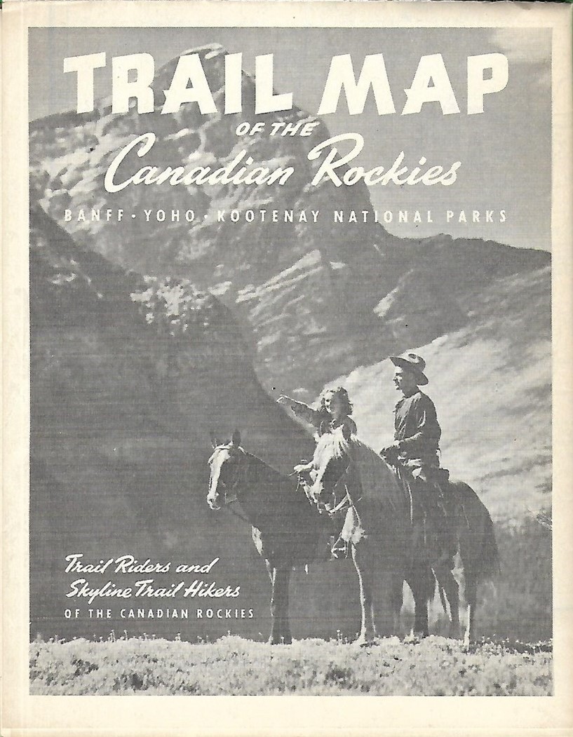
Original 1937 CANADIAN ROCKIES TRAIL MAP Banff Yoho Kootenay National Parks For Sale

When you click on links to various merchants on this site and make a purchase, this can result in this site earning a commission. Affiliate programs and affiliations include, but are not limited to, the eBay Partner Network.

Original 1937 CANADIAN ROCKIES TRAIL MAP Banff Yoho Kootenay National Parks:
$24.99
Large-format fold out map published by Trail Riders and Skyline Trail Hikers of the Canadian Rockies, circa 1937. - The map opens to 28½" x 22" and locates trails, auto roads, railroads, wardens' cabins, post offices, glaciers, park boundaries, and elevations, with heights in feet above sea level, with cartography by Rand McNally.
- There are more than a dozen black and white photos on the reverse side, along with a list of trails in Banff National Park and information on the history and aims of Trail Riders and Skyline Trail Hikers of the Canadian Rockies.
- Condition: This map is in excellentcondition, bright and clean, with no marks, rips or tears. Be sure to take a look at the scans and feel free to ask any questions.
- The map is undated and was published circa 1937.
- Approximately halfway between Banff and Lake Louise, it labels Castle Mountain, renamed Mount Eisenhower in 1946, in honor of World War II general Dwight D. Eisenhower. (The original name of Castle Mountain was restored in 1979.)
- Buy with confidence! We are always happy to combineshipping on thepurchase of multiple items — just make sure to pay for everythingat one time, not individually.
Powered by SixBit's eCommerce Solution
|
|
Related Items:
Original 1937 German Regimental Stein $225.00
Original 1937 Disney Snow White Dopey Storyboard Panel Production Artwork $420.00
1937 English Version 8 Bottles of Pelican Ink in Original 12 Space Box $175.00
|
|
|
Shopping Cart  |

|
Recently Viewed |
|
Latest Items |
|
Facebook |
Secure Websites

|
