When you click on links to various merchants on this site and make a purchase, this can result in this site earning a commission. Affiliate programs and affiliations include, but are not limited to, the eBay Partner Network.
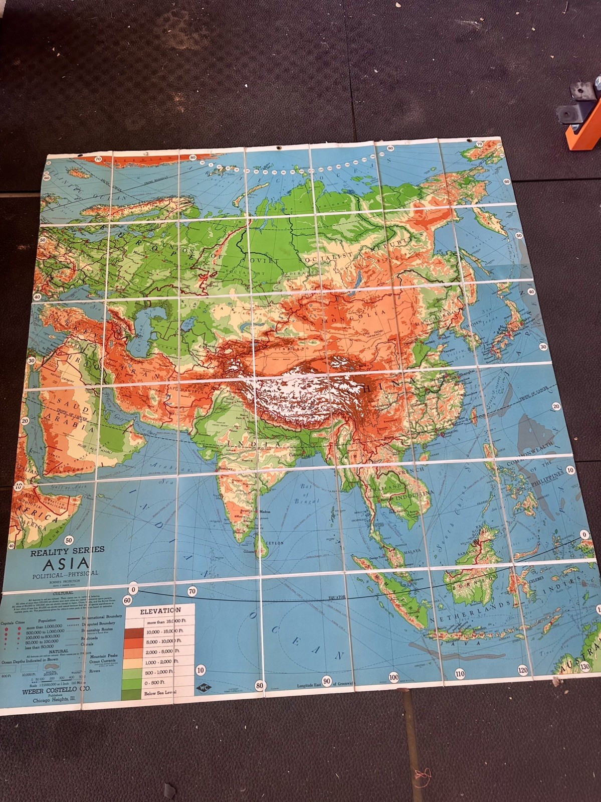
USSR EraVintage Weber Costello “Reality Series” political-physical map of Asia. Mid-century American classroom map published in Chicago Heights, Illinois. Edited by Edith Putnam Parker. Bonne’s projection. Scale 1:7,000,000 (1 inch = 110 miles).
Folding sheet version (not a roller pull-down). Opens to a large wall-size map; folds down to a compact packet.
Dimensions
• Folded: 8” x 11”
• Open: 64” long x 59” wide
• About 7 ft on the diagonal
What it shows
• Late-1950s political boundaries: Union of Soviet Socialist Republics, People’s Republic of China, Bombay still labeled, British Somaliland still shown separately
• Physical relief with elevation color bands
• Capitals, city population symbols, railroads, steamship routes, canals, mountain peaks, ocean depths
• Full legend for cultural and natural features
Publisher block
REALITY Projection
Edited by Parker
Weber Costello Co.
Publishers
Chicago Heights, Ill.
Date
Best estimate circa 1958 (late 1950s). USSR intact; British Somaliland still labeled as a separate territory (Somalia independence was 1960).
Condition
Used vintage school map. Original fold grid. Colors still strong in the photos. Expect typical age wear: crease wear, light soiling, possible small tears or stains at folds. Please review all photos — they are part of the description. Sold as-is.
Why it’s interesting Classic 1950s U.S. school geography piece. Works as wall display, teaching aid, or Cold War-era decor. Weber Costello was a major American maker of classroom maps and globes.
Shipping Ships folded to 8” x 11” in a rigid mailer or small box so the folds don’t get crushed. Combined shipping available.
Questions welcome. Smoke-free home.