When you click on links to various merchants on this site and make a purchase, this can result in this site earning a commission. Affiliate programs and affiliations include, but are not limited to, the eBay Partner Network.
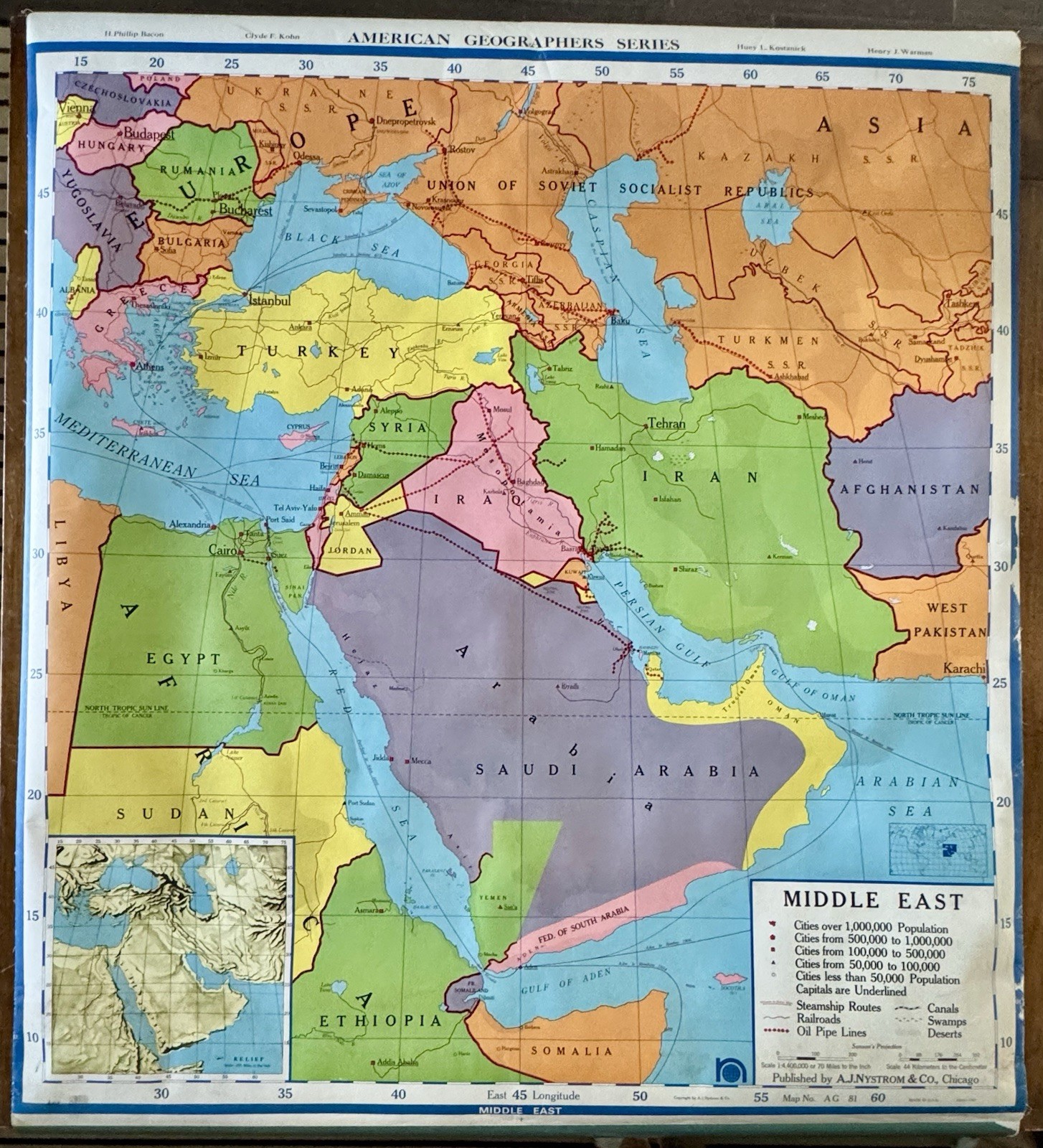
Original 1967 A.J. Nystrom & Co. political wall map of the Middle East (Map No. AG 81 60), published in Chicago for educational use. This authentic vintage classroom map captures the geopolitical landscape of the late 1960s, including historical entities such as the Federation of South Arabia, the Union of Soviet Socialist Republics (USSR), and pre-modern Middle Eastern borders that no longer exist today.A fascinating historical reference piece for collectors, educators, historians, map enthusiasts, or anyone interested in Cold War-era cartography. The map features vivid colors, political boundaries, major cities, transportation routes, and an inset physical relief map.Mounting hardware is not included.Features * Original 1967 A.J. Nystrom & Co. classroom wall map
* Map No. AG 81 60
* Political map of the Middle East
* Published in Chicago, USA
* Depicts historical Cold War-era borders
* Shows the Federation of South Arabia and USSR
* Includes transportation routes and political boundaries
* Inset physical relief map
* Large display size ideal for framing or décor
* Authentic educational cartographyDimensions * Printed Map: 45 x 42.5 inches
* Overall Size: 51.5 x 42.5 inchesCondition Notes
Good vintage condition with expected age-related wear from classroom use and storage. Colors remain vibrant and graphics are clear. Mounting hardware is not included. Please review all photographs carefully, as they are part of the item description.Keywords
Vintage map, A.J. Nystrom, Nystrom map, 1967 map, Middle East map, political map, classroom wall map, school map, Cold War, USSR, Federation of South Arabia, historical cartography, educational map, geography, atlas, Chicago publisher, world history, collectible map, wall décor, paper ephemera, vintage classroom decor