When you click on links to various merchants on this site and make a purchase, this can result in this site earning a commission. Affiliate programs and affiliations include, but are not limited to, the eBay Partner Network.
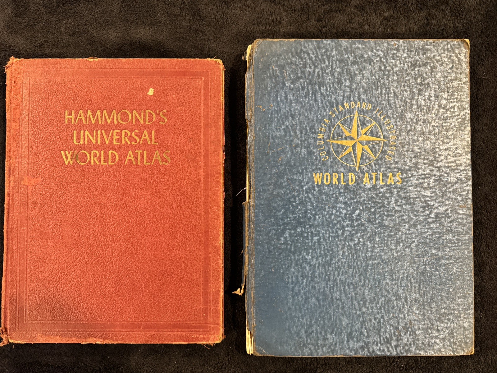
Lot of 2 original vintage World War II-era hardcover world atlases dating from the early 1940s. Both contain historical maps, geographical information, and period reference material documenting the world during WWII.ATLAS 1 - HAMMOND\'S UNIVERSAL WORLD ATLAS (1944)Published by C. S. Hammond & Company, Inc., New York. Original 1944 publication with matching title page and copyright date.Features detailed world and United States maps, political boundaries, geographical descriptions, historical statistics, and illustrations.Notable contents include:
- War in the Pacific, page 142
- Austria-Czechoslovakia in 1938, page 143
- Political maps of countries and continents
- Individual United States maps
- World population statistics and geographical reference material
- Illustrated world geography sectionATLAS 2 - THE COLUMBIA STANDARD ILLUSTRATED WORLD ATLAS (1942-1943 COPYRIGHT)Published by Columbia Educational Books, Inc., Chicago. Copyright 1942 and 1943 by Consolidated Book Publishers, Inc.Revision Editor: Franklin J. Meine
Editor: Kathryn McDanielContains historical geographical information, political maps, country descriptions, period illustrations, and extensive reference material.Contents include:
- Descriptions of principal world countries, pages 9-99
- Our Celestial Neighbors, pages 100-111
- Our Terrestrial Home, pages 112-113
- Maps of the United States and other countries, pages 114-192
- General Index, pages 193-256Includes historical population statistics, colonial territories, political divisions, capital cities, and international time differences.CONDITION:
Both atlases are in vintage used condition with substantial age-related wear. Original hardcover bindings show rubbing, fraying, worn corners, edge damage, and spine deterioration. The blue Columbia atlas has significant binding damage. Interior pages show age toning, discoloration, staining, and some tears or edge damage. A loose map is visible. Completeness has not been verified.Both books are being sold together as one lot, exactly as pictured. No restoration has been attempted.Interesting historical reference books for collectors of WWII-era maps, vintage atlases, cartography, geography, and early 20th-century history.Please review all photographs carefully for condition and contents.