When you click on links to various merchants on this site and make a purchase, this can result in this site earning a commission. Affiliate programs and affiliations include, but are not limited to, the eBay Partner Network.
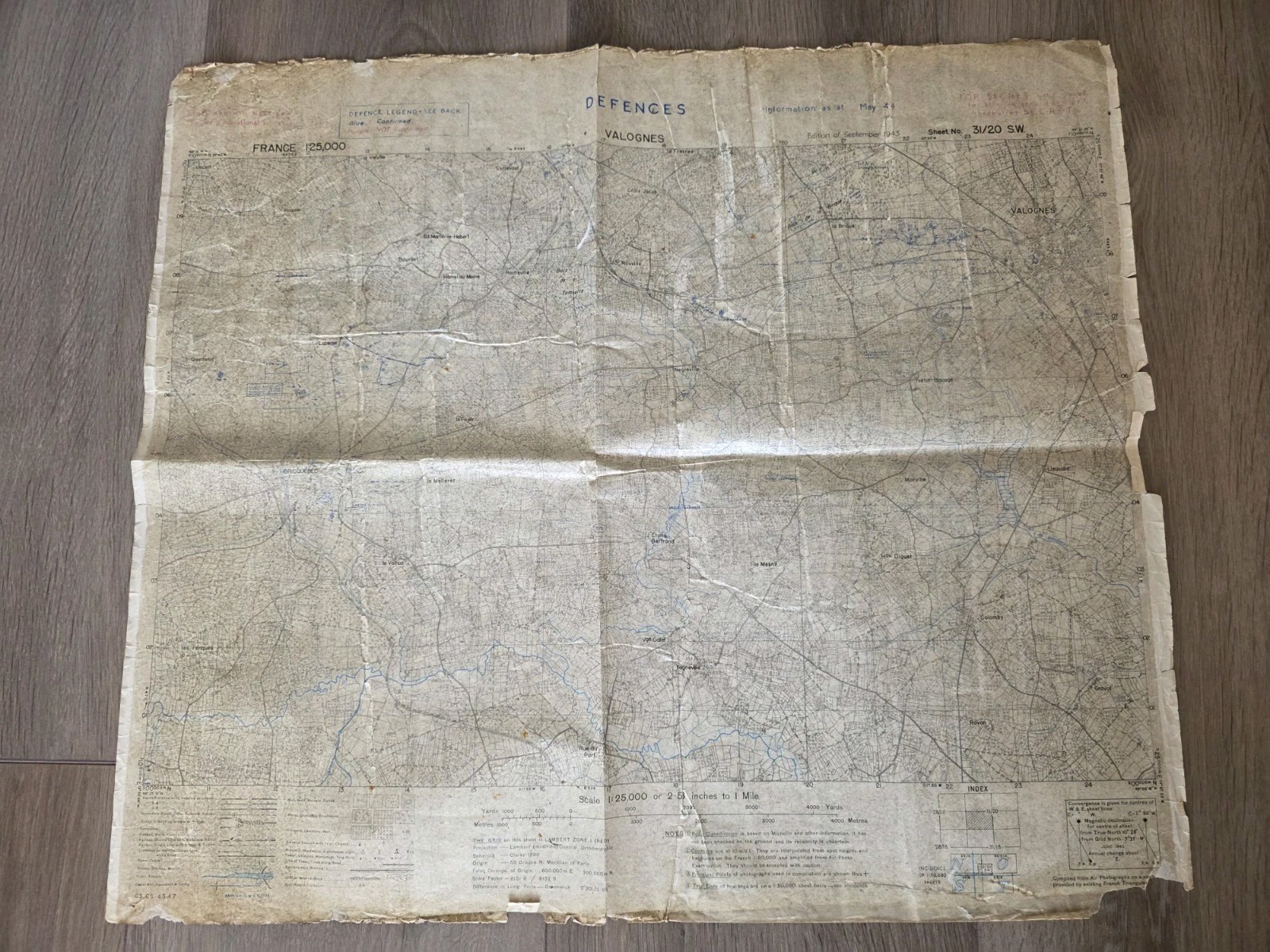
Original US Army military staff map for the Normandy invasion, June 1944. This rare 1:25,000 scale map covers the Valognes/Bricquebec sector, a key area of operations during the Battle of Normandy.
Historical Significance:
This sector was a primary objective for the US 82nd Airborne Division (All American). Paratroopers from the 505th, 507th, and 508th Parachute Infantry Regiments (PIR) operated in and around this region to cut off German reinforcements and secure the route to the port of Cherbourg. Elements of the 101st Airborne Division and the 4th Infantry Division also pushed through this area during the breakout from Utah Beach.
Key Features:
Rare Defences Edition: Includes blue and purple overprints showing German trench systems, artillery positions, and obstacles, with intelligence updated to May 1944.
High Classification: Stamped TOP SECRET until issued for briefing ground troops.
Authentic Field Coating: The map has a characteristic tacky or waxy surface texture. This is the original wartime weatherproofing applied to protect the map from rain and mud during the invasion. This coating has absorbed into the paper over 80 years, proving this map was prepared for active combat service.
Condition: Exhibits genuine wartime wear, fold aging, and edge fraying, adding to its historical integrity.
A museum-grade document from Operation Overlord.