When you click on links to various merchants on this site and make a purchase, this can result in this site earning a commission. Affiliate programs and affiliations include, but are not limited to, the eBay Partner Network.
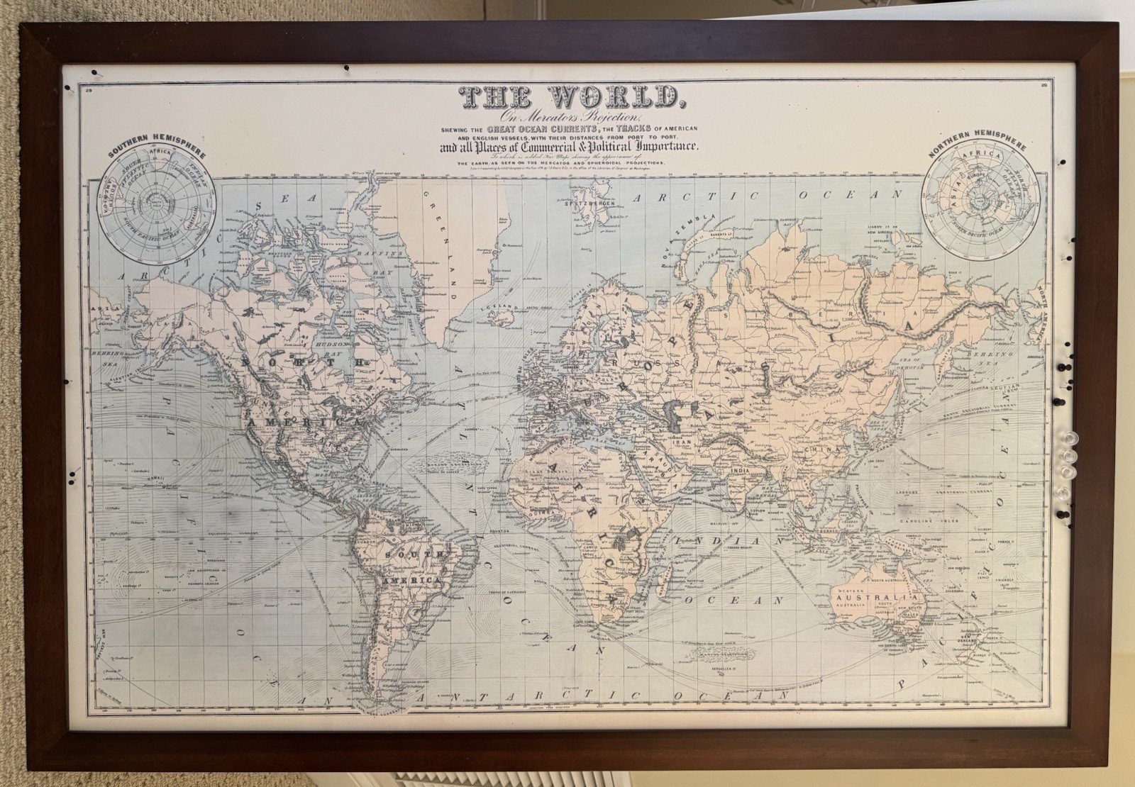
1874 World Map Wood Framed with hanging wire. LOCAL PICKUP ONLY (near corner of Talbot and Catalina in Point Loma area of San Diego, Ca)
A world map titled “The World on Mercator's Projection.
Subtitle: "Shewing the Great Ocean Currents, the Tracks of American and English Vessels, with their distances from port to port and all Places of Commercial & Political Importance." Features include two circular inset diagrams in the corners showing the Northern and Southern Hemispheres.
Smallest print in top section says at last line: “Entered according to act of congress in the Year 1874 by J.B.Beers & Co, in the office of the Librarian of Congress at Washington.”
Cartographic Style: Hand-colored pastel lithograph reproduction style standard of late 19th-century American and British geography atlases.
Hemisphere Insets: Two circular polar projections in the upper corners showcase the Northern Hemisphere and Southern Hemisphere mapping layout from an axial perspective.
Historical Accuracy: Features unmapped white patches around the deep Arctic and Antarctic zones, reflecting the early exploration limits of the 1870s.