When you click on links to various merchants on this site and make a purchase, this can result in this site earning a commission. Affiliate programs and affiliations include, but are not limited to, the eBay Partner Network.
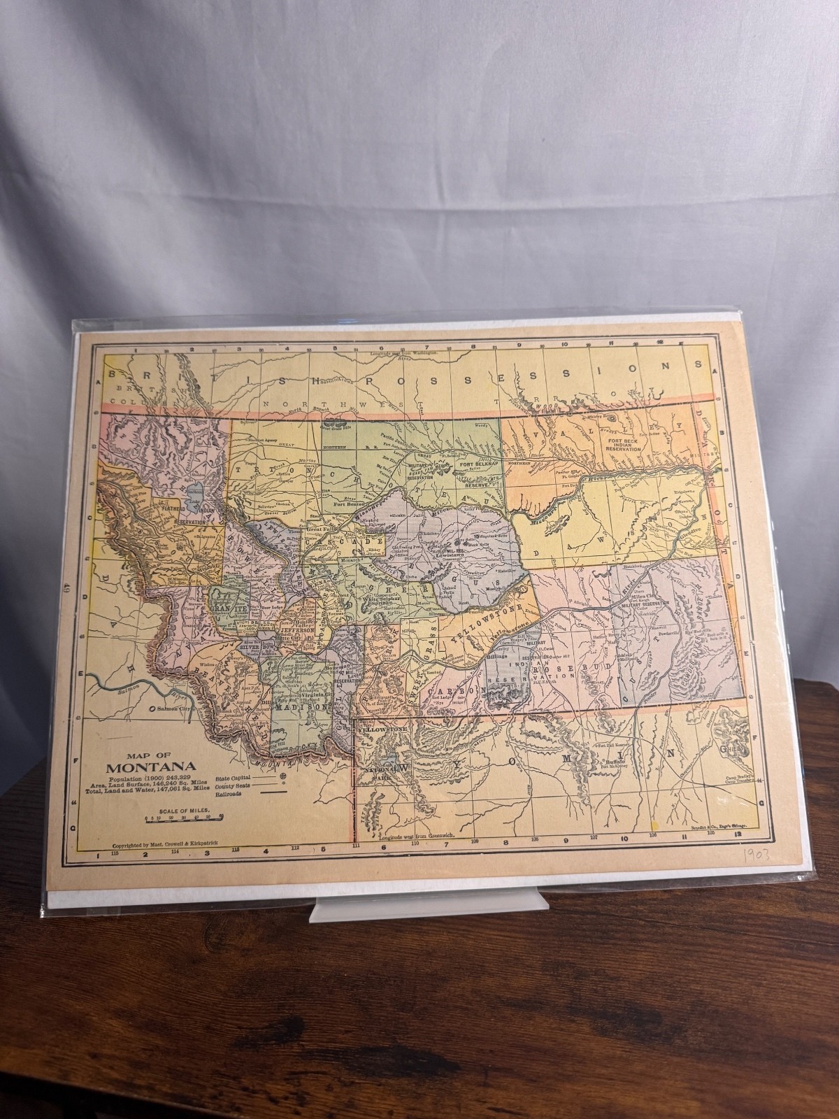
1903 Montana Antique Atlas Map by Rand McNally
Offered for sale is an authentic 1903 antique map of Montana, published by Rand, McNally & Co. This is an original atlas page and not a modern reproduction.
This beautifully detailed map depicts Montana during the early twentieth century and includes counties, towns, railroads, rivers, mountain ranges, Native American reservations, and other important geographical features of the period.
Its detailed topography and historical significance make it an outstanding piece for collectors of Western Americana, Montana history, genealogy, railroad history, or antique State: Montana
* Year: 1903
* Publisher: Rand, McNally & Co.
* Original antique atlas page
* Printed on original paper
* Unframed
* Ships in a protective plastic sleeve with a rigid backing board
Condition
Very good antique condition with light age-related toning and minor wear consistent with its age. The map has been stored in a protective plastic sleeve with a rigid backing board and will be shipped flat for safe delivery.
Please review all photographs carefully, as they are part of the description.