When you click on links to various merchants on this site and make a purchase, this can result in this site earning a commission. Affiliate programs and affiliations include, but are not limited to, the eBay Partner Network.
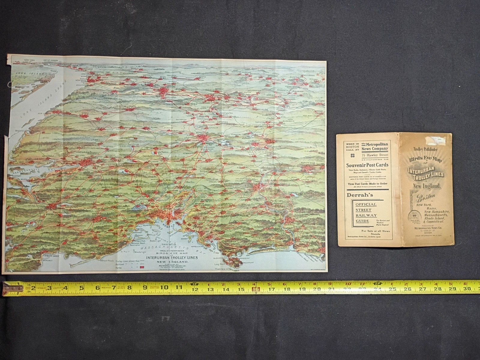
This large color folding map provides a detailed bird’s-eye view of the extensive early electric trolley and interurban railway network throughout New England, with particularly strong coverage of the Boston metropolitan area and surrounding Massachusetts communities. Routes also extend into Rhode Island, Connecticut, New Hampshire, and portions of New York.
The map includes numerous cities, towns, trolley routes, connecting railroads, parks, and transportation points, making it an excellent reference piece for collectors of early transit history, street railways, Boston-area history, railroadiana, and antique maps.
The accompanying Trolley Pathfinder cover/booklet section is also included.
Details:
- Date: 1905
- Subject: Interurban trolley and street railway lines
- Region: Boston and New England
- Publisher: Metropolitan News Company, Boston
- Bird’s-eye / pictorial map format
- Printed in color
- Large folding map, approximately 14 x 20 inches
- Original period piece
Condition:
Map has been opened and is currently stored flat. Original fold lines remain visible. There is age-related toning, fold wear, edge wear, and minor handling wear consistent with an original early-20th-century folding map. Please review all photographs carefully for exact condition and completeness.
A scarce and visually impressive piece documenting the enormous trolley and interurban network that once connected communities throughout New England. Excellent for display, research, or a specialized transportation or map collection.