When you click on links to various merchants on this site and make a purchase, this can result in this site earning a commission. Affiliate programs and affiliations include, but are not limited to, the eBay Partner Network.
1906 Political History timeline - Our Political History
-See more info below-
This is a modernUNFRAMEDreproduction of the original chart -Frames areNOTIncluded
The Images Shown is for Illustration Purposes Only.
Size:
16x76 Inches
Two prints combine on one sheet of paper.
We have moreCharts like this, you can find them in
Our Store
All Our Maps and Posters Are Made in the USA
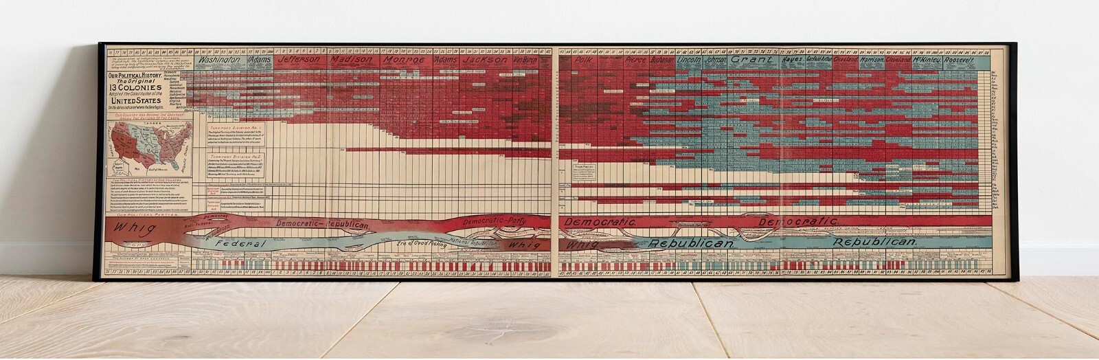
OUR POLITICAL HISTORY The Original 13 COLONIES Adopted the Constitution of the united states On the dates indicated where the State begins. [Springfield, Mass.: W. C. King Company, 1906.]
A visually striking timeline of American political history, cleverly designed, vividly illustrated and deeply patriotic.
Two prints combined on one sheet of paper to form a timeline from Independence to the second Presidential administration of Theodore Roosevelt. The upper sections list, year-by-year, the Presidents, their cabinet members, and the governors of each state, color coded—counterintuitively to modern eyes–blue for Republicans and red for Democrats. Below this a diagram charts the evolution and interrelationships of the major and minor political parties, which are depicted them as streams flowing in to and out of one another. For example the Federalist “stream” is shown merging with the Democratic-Republicans around 1820, though by the Election of 1828 the Republicans are shown diverging into Democratic and National Republican streams.
The diagram is a terrific application of naturalistic “stream” imagery to political history. The metaphor has deep antecedents, going back at least to Friedrich Strass’s 1803 Strom der Zeiten, which applied it to the rise and fall of peoples, nations and empires. The metaphor was adapted for a variety of religious and secular topics throughout the 19th century, and was first applied to American politics by Walter R. Hougton in his Conspectus of the History of Political Parties and the Federal Government (Indianapolis: Granger, Davis & Co.). This was then updated in wall-map format by Chicago publisher F.T. Neely as Houghton’s New Reversible Political Map and United States Map Combined. Close comparison of this 1906 diagram indicates that it is adopted from Neely’s work with updates to the administration of Theodore Roosevelt.
AN INVALUABLE RESEARCH TOOL DISGUISED AS ART
CHART THAT LOOK OLD: This chart is a reproduction of an antique poster, this INCLUDES stains, creases and muddy areas that are ON the ORIGINAL map. Defects are NOT due to poor print quality but reflect the original antique/vintage map image. Please see close up views for examples.
100% GUARANTEE AND MADE IN USA: We print and distribute our posters from the USA. We offer a fast, often 1 day production rate and gladly respond to questions or issues promptly.
- Printed on premium 46lb matte paper with fade resistant archival inks and includes a white border on all sides to allow for matting and framing.
- Please note that there may be some variation in the color of the on-screen image and the actual item received. This is subject to the brightness and contrast of your screen settings.
- This is a modern UNFRAMED reproduction of the original print - Frames are NOT are the prints shipped?They are rolled and placed into a rigid tube or box.
-Is this available in a larger/smaller size.For smaller or larger sizes, email us.