When you click on links to various merchants on this site and make a purchase, this can result in this site earning a commission. Affiliate programs and affiliations include, but are not limited to, the eBay Partner Network.
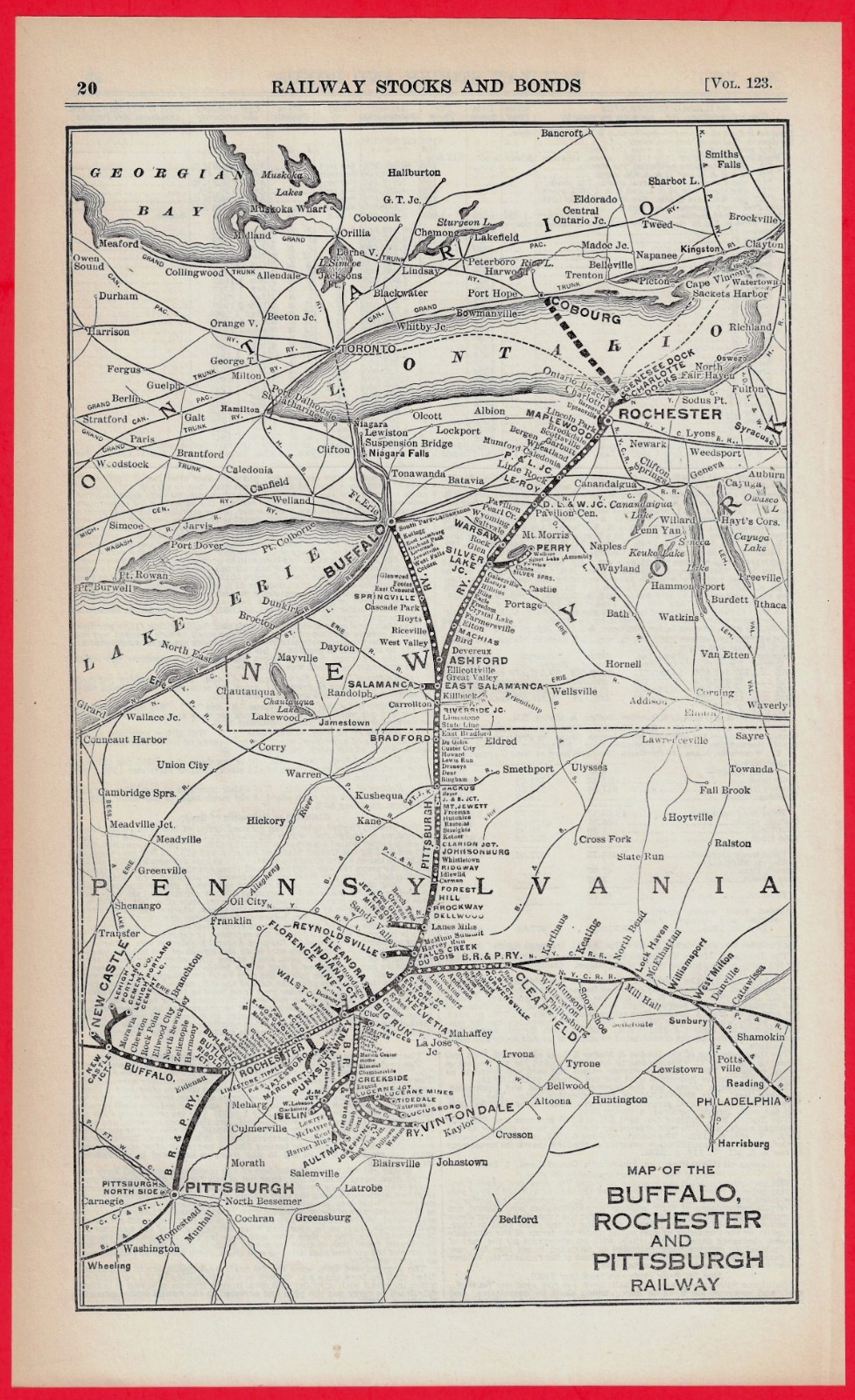
Type: Railway System Map; dated November, 1926.Dimensions: 7-3/4" x 12-3/4.Condition: Very Nice / Vintage Original
Original 1926 Buffalo, Rochester & Pittsburgh Railway System Map. Originally published as a financial supplement for railroad investors and captures the network at its absolute peak, just a few years before it was absorbed by the Baltimore & Ohio (B&O) in 1932.
Coverage: Explicitly displays the iconic "Y" route extending from the coalfields of Western Pennsylvania (Du Bois, Punxsutawney, Ridgway) up through Ashford Junction to the northern terminals at Buffalo and Rochester, New York. It also details critical trackage rights into Pittsburgh.
Condition Report: This map is in very nice vintage condition. The paper remains clean and bright with excellent contrast, crisp text, and sharp line lithography. Ready for framing or adding to a historical archive.
776 Our 27th year on