When you click on links to various merchants on this site and make a purchase, this can result in this site earning a commission. Affiliate programs and affiliations include, but are not limited to, the eBay Partner Network.
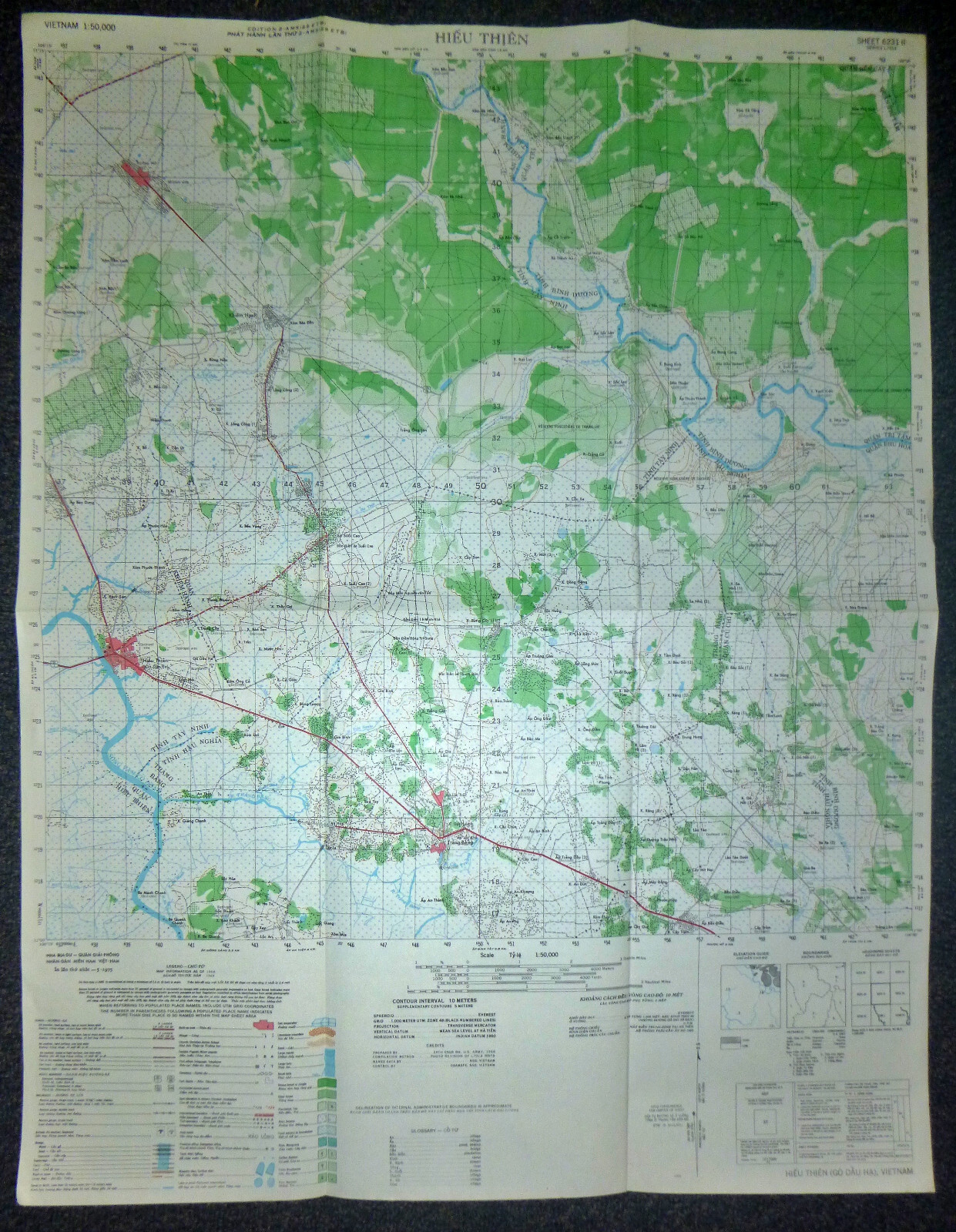
Vietnam War - US Military Map - 1968Captured by Viet Cong at end of War, May 1975Ho Chi Minh Trail - Tay Ninh, Hieu Thanh, Khiem Hanh, Binh Duong, Tri Tam, Ben Cat, Phu Hoa, Hau Nghia, Cu Chi, Trang Bang, Cu Chi
Tay Ninh:Located near the Cambodian border, Tay Ninh was a critical base for both U.S. and ARVN (Army of the Republic of Vietnam) operations. It was also close to the Ho Chi Minh Trail, which was essential for the North Vietnamese supply line.Cu Chi Tunnels:This extensive network of tunnels used by the Viet Cong provided cover for troops, storage for supplies, and served as a base for guerrilla operations. The tunnels played a crucial role during the Tet Offensive in 1968 and remained a strategic asset for the Viet Cong.Binh Duong:A province heavily contested during the war, it saw significant battles and was home to important military installations. The region\'s proximity to Saigon made it a target for both sides, leading to fierce fighting.Ben Cat and Phu Hoa:These areas were part of the Iron Triangle, a stronghold for the Viet Cong. They were crucial for launching attacks against U.S. and ARVN forces and were targeted during Operation Cedar Falls in early 1967.Hieu Thanh and Khiem Hanh:These smaller locations were often the sites of skirmishes and operations aimed at disrupting Viet Cong activities. They highlighted the decentralized nature of the conflict, where even lesser-known areas saw significant military action.Hau Nghia and Trang Bang:These areas experienced intense fighting and were significant in the context of the Tet Offensive. The fighting here contributed to the overall instability in the region, with both sides striving for control.Tri Tam:While less known than some other locations, Tri Tam was involved in the broader context of the conflict. Smaller operations in such areas often had cumulative effects on the war effort.The Tet Offensive (1968)
The Tet Offensive was a turning point in the Vietnam War and had a significant impact on public perception and military strategy. Many of the locations you mentioned, particularly Cu Chi and Tay Ninh, were involved in the offensive, which aimed to galvanize support for the Viet Cong and North Vietnamese forces.
Vietnam War MAP
- Measures - 29 x 22.5 inches ( 74 x 59 cms )
MAP Series – L7014
The 1:50,000topographic map series L7014, produced by the U.S. Army during the Vietnam War,provided detailed geographical information essential for military operations.These maps were created using aerial photography and field surveys, offering acomprehensive view of specific areas in Vietnam.
With a scale of1:50,000, these maps depicted one centimeter on the map as equivalent to 500meters on the ground (or 1,000 meters per grid), allowing for precise locationreferencing and detailed representation of the terrain. The maps includedcontour lines to show elevation and terrain features such as hills, valleys,and mountains. Hydrography was detailed with rivers, streams, lakes, and otherbodies of water clearly marked, while different types of vegetation cover, suchas forests, grasslands, and agricultural areas, were also indicated.
Man-made features wereextensively detailed, including various types of roads from major highways tosmall trails, railways, bridges, and ferries. Locations of towns, villages, andcities were marked, providing a clear view of built-up areas. Military installations,such as bases, airfields, and defensive structures, were identified, along withany notable strategic points like supply depots, command centers, andcommunication hubs.
During the VietnamWar, these maps were crucial for planning and conducting military operations,enabling commanders to understand the terrain, plan routes, and locate enemypositions. The detailed topography and man-made features facilitated navigationand tactical planning.
Today, these maps arevaluable for historical research, offering insights into the geography andlogistics of military operations during the Vietnam War. They are also ofinterest to military collectors, veterans and their families, helping themlocate specific places of personal significance from the war.