When you click on links to various merchants on this site and make a purchase, this can result in this site earning a commission. Affiliate programs and affiliations include, but are not limited to, the eBay Partner Network.
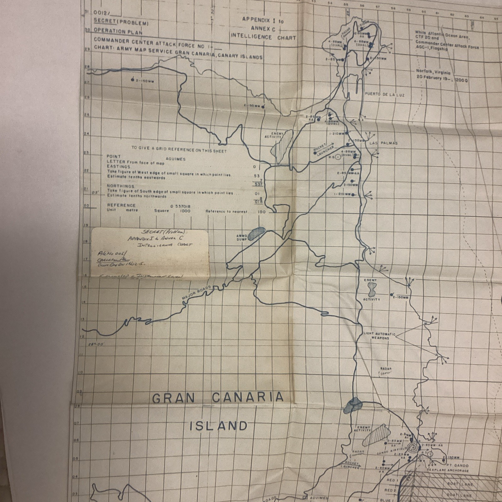
Up for sale is a Old Army Map Service of the Canary Islands.
Appendix I to Annex C.
Folded Map.
I believe it’s from WW2 World War 2 depicting the Canary Islands.
It does not show a date, so I can not confirm if it’s Original.
Shows Activity around Canary Islands. Enemy Activity, Rocket Launchers, Ammo Dump, Light Automatic Weapons.
Appendix I to Annex C.
Operation Name : Secret Problem.
Operation Plan: Commander Center Attack Force.
Chart: Army Map Service Gran Canaria, Canary Islands.
Has Pencil writing on it.
You can see erased & was rewritten “North Gunfire Support Area”.
Also in Pencil written in:
South Gunfire Support Area.
Transport Area.
Boat Lanes.
Sweep Area
Folded Map. So Creases are a given.
Shows signs of wear. No tears.
Has Some Yellowing.
Some hard creases (Near Grando Airfield, round circle reads “75 VF”, see closeup pics).
No Date Found On It.
Found As Is Sold As Is.
Please look at pics before offerding.
Approx. 32” x 31”.
Please ask questions.
I have attempted to describe condition of sign to the best of my ability.
You will receive what is pictured.
FREE USPS Priority Mail Shipping to all 50 States
NO INTERNATIONAL Shipping. NO Shipping to Canada
Feel free to ask questions. I will answer to the best of my ability