When you click on links to various merchants on this site and make a purchase, this can result in this site earning a commission. Affiliate programs and affiliations include, but are not limited to, the eBay Partner Network.
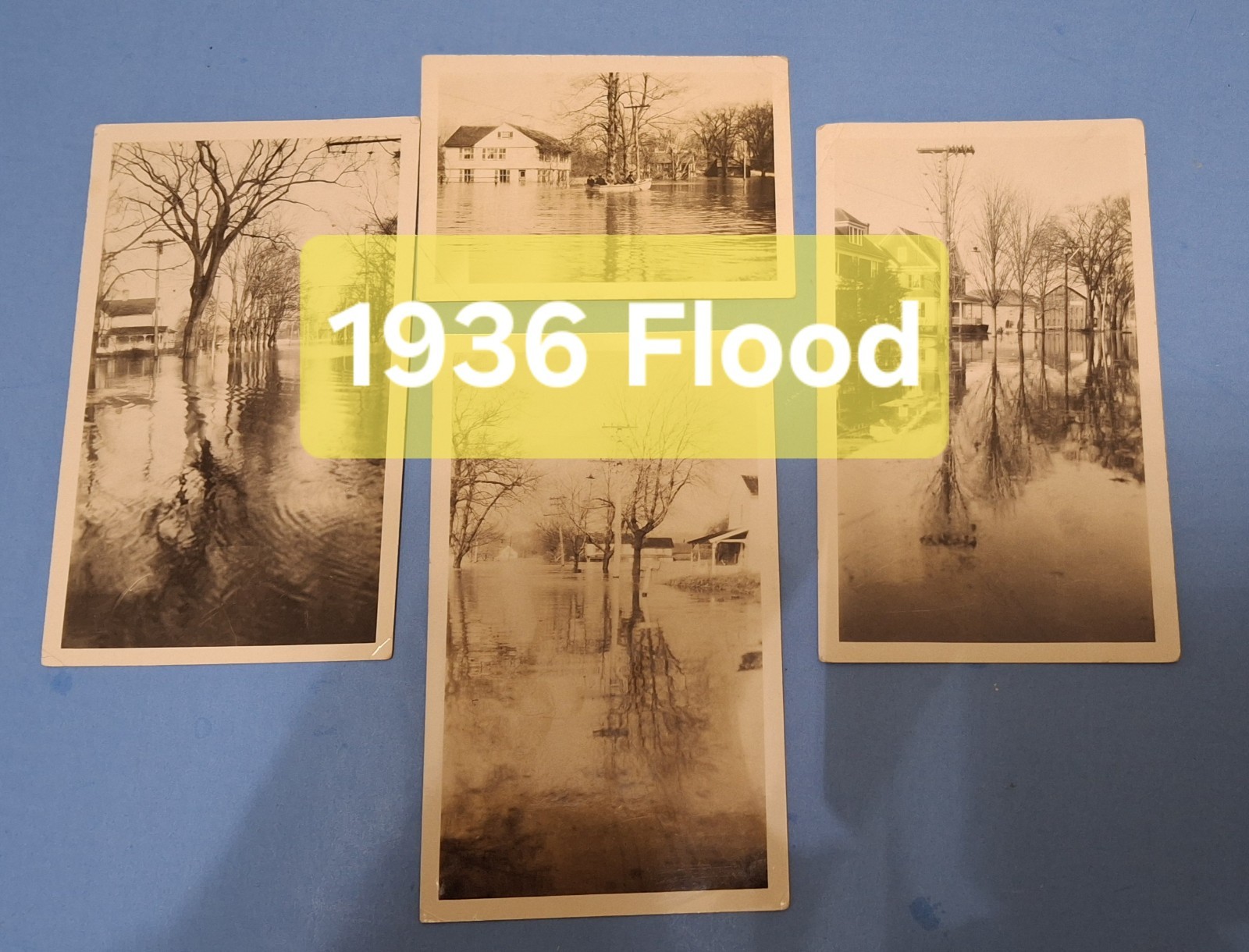
These are from the 1936 flood. Pictures appear to be mostly in South Glastonbury Connecticut.
They do have the names of the streets on the back .
One has main Street. I\'m guessing this is around Hubbard Street is that\'s probably the most likely area to flood
One is ferry Lane. You can see the farm on the right hand side as it gets down near the river. I lived on this street
Killians River road. That\'s what\'s written on the back this looks like Tryon Street to me with possibly the Kenny house but couldn\'t be killiam\'s farm
The last one is not Naubuc Avenue. Not sure if this is looking north or south but I believe looking north
The pictures are three by five in size except for the one on Tryon Street which is two and a half by three and a half inches
Sold as is please ask any questions prior to purchase or offerding